Hiking in Lagodekhi
Lagodekhi is a relatively new destination for hiking enthusiasts. Although the Lagodekhi National Park was established in 1912, the lack of infrastructure in the past prevented travelers from visiting it. At present, there is still a process of construction and widening of hiking trails, improvement of mountain huts and several new accommodations have been added in Lagodekhi town.
Trails
Almost all trails are well marked, there are several huts along the multi-day trail to alpine lakes, and the area is patrolled by mountain rangers.
Structure
From 590m to 3500m, the area consists mainly of forest and alpine meadows. There are NO glaciers in the Lagodekhi area, only snow during the winter months.

Good to Know
Lagodekhi is border region with Azerbaijan and Russia, so before your hiking trip to the Black Rock Lakes, make sure to get hiking travel permits.
Distance: 160km from Tbilisi (2.5 hours).
Best time for hiking: You can hike all year around, though July and August could bit slightly too hot (except Black Rock Lake route), better to do during the spring or autumn.
Ninoskhevi Waterfall
Distance: 14.5 km (round trip)
Duration: 6-7 hours
Minimum Elevation: 600 m
Maximum Elevation: 1010 m
Total climb: 650m
Total descent: 650m
Ninoskhevi is the biggest waterfall in Lagodekhi area, starting from Khizabavra village. A new wide trail has been added, which follows the valley from higher altitude instead of the river bed. This is an easy day hike and can be done by children and elderly in good physical shape.
Machi Fortress
Distance: 11.3 km (round trip)
Duration: 4-5 hours
Minimum Elevation: 405m
Maximum Elevation: 690m
Total climb: 640m
Total descent: 640m
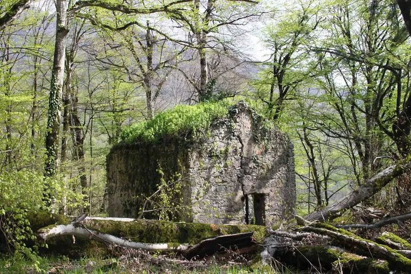
Hiking route starts from Matsimi village and follows to the valley to the ruins of the castle. Built in the 16th century, large parts of the fortress has been ruined and what has survived has been partially restored in 2016 by the National Agency for Cultural Heritage.
Grouse Waterfall
Distance: 9.2 km
Duration: 3-4 Hours
Minimum Elevation: 555m
Maximum Elevation: 655m
Total climb: 420m
Total descent: 420m
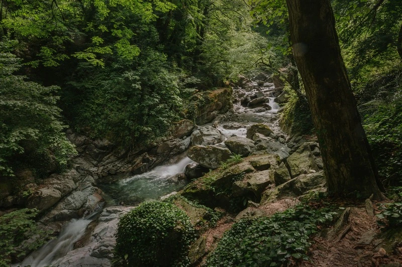
Relatively easy and short hiking trail that starts from the Northern outskirts of Lagodekhi town. It takes you to the valley with small cascading waterfalls. The greatest feature of this route is forest, more than waterfalls themselves. Also great option for trail running.
Black Rock Lake
Distance: 37.5 km
Duration: 2-3 Days
Minimum Elevation: 555m
Maximum Elevation: 2860m
Total climb: 2560m
Total descent: 2560m
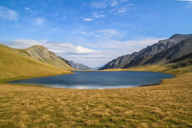
The Black Rock Lake Route is the most famous hiking trail in Lagodekhi, but it’s also the most difficult. With steep climbs and descents, it crosses different climatic zones, ascending to alpine zones, which can receive snowfall even in summer, and descending to the subtropical climate of Lagodekhi town. Trekking should be done during July, August and September. Be sure to bring plenty of water, as the trail follows the ridge with little to no water supply along the way.