Hiking in Borjomi
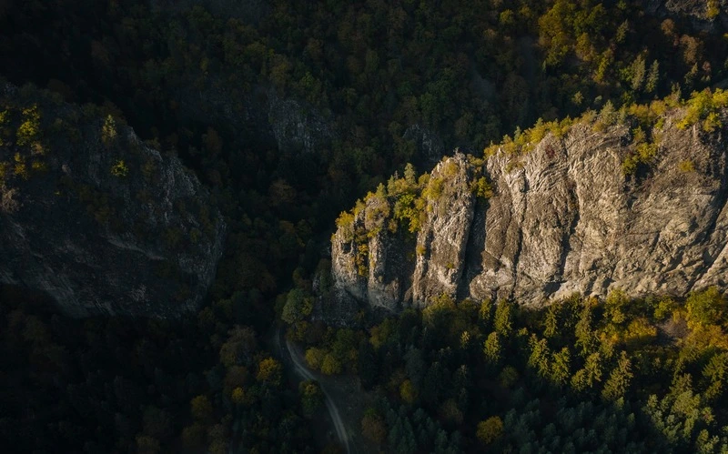
One of the pearls of the South Caucasus mountains, the Borjomi area is famous for its dense coniferous forests, flowering alpine meadows and natural volcanic waters. Here you can hike all year round, with all kinds of difficulty trails, including multi-day hikes and snowshoe trails. The only disadvantage of this area in comparison with the North Caucasus is the lack of natural spring water along the trails. This is due to the fact that most of the trails are built on the ridges instead of the valley floor.

Trails
Almost all trails are well marked, there are several huts along the multi-day trails, and the area is patrolled by mountain rangers.

Structure
From 800m to 2,650m, the area consists mainly of forest and alpine meadows. There are NO glaciers in the Borjomi area, only snow during the winter months.

Good to Know
For the best tracks, arrive in the small village of Likani instead of Borjomi town. From here you can choose several hiking routes.
Distance: 150km from Tbilisi (2 hours), or 150km from Kutaisi International Airport (2 hours)
Best time for hiking: You can hike all year around, though July and August could bit slightly too hot, better to do during the spring or autumn.
NPI Trail
Distance: 2.8 km
Duration: 1-2 hours
Minimum Elevation: 838 m
Maximum Elevation: 986 m
Total climb: 180 m
Total descent: 181 m
The “National Parks Information” trail is the shortest and easiest hike in Borjomi. Within 2 hours you will finish the trail.
Footprint Trail
Distance: 16.9 km
Duration: 6-7 hours
Minimum Elevation: 891 m
Maximum Elevation: 1771 m
Total climb: 889 m
Total descent: 885 m
The trail starts from Likani village, follows the ridge and finally arrives 8km south of Likani village, in Kvabiskhevi village.
Nikoloz Romanov’s Trail
Distance: 37.8 km
Duration: 2 days
Minimum Elevation: 445 m
Maximum Elevation: 2128 m
Total climb: 1472 m
Total descent: 1918 m
Nikoloz Romanov’s trail starts in Likani village, same as “Footprint Trail”, but on the ridge it goes further north, eventually arriving in Lomis Mta tourist shelter, just before the Lomis Mta mountain. This tourist shelter is located in an alpine zone, just above the tree line.
The next day you will have to hike down through the Colchic subtropical forest and after 12km you will reach the Sakhvlari tourist shelter.
On the third day you will follow the Shavistskala river valley all the way to the village of Marelisi (you will have to pass the ranger’s house).
St. Andrew’s Trail
Distance: 53.4 km
Duration: 3-4 Days
Minimum Elevation: 446 m
Maximum Elevation: 2580 m
Total climb: 2218 m
Total descent: 2690 m
By far the longest trail in Borjomi, St. Andrew’s Trail starts with a 14km trek to Amarati shelter. The next day it reaches the highest peak in the Borjomi area, Mt Samtskhvario (2640m), and you can spend the night at the Samtskhvario ranger hut.
On the third day you will still follow the trail through the alpine zone, you will pass by the Kvazvinevi ranger station (you could have arrived here the day before or stay here to extend your trip up to 5 days) and descend to the Sakhvlari tourist shelter, the point where the “Nikoloz Romanovs’s” and “St. Andrew’s” trails meet.
The fourth day is similar to the previous track, hiking all the way to the village of Marelisi.